Ground Penetrating Radar in Forensic Archaeology: How Hidden Graves Are Found
Introduction
Locating hidden graves is one of the greatest challenges in forensic archaeology. Whether investigators are searching for victims of historical conflicts, undocumented cemeteries, disaster victims, or evidence connected to criminal investigations, disturbing the ground without clear evidence can be expensive, destructive, and time-consuming.
This is where ground penetrating radar in forensic archaeology has become one of the most valuable investigative tools available.
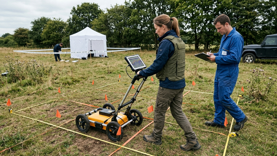
Ground Penetrating Radar (GPR) allows investigators to examine what lies beneath the surface without digging. By transmitting high-frequency radio waves into the ground and measuring how they reflect from buried objects and soil disturbances, GPR creates images that help archaeologists identify possible graves, foundations, tunnels, and other hidden features.
Today, ground penetrating radar in forensic archaeology is used worldwide by forensic teams, archaeologists, and humanitarian organizations to locate burial sites while preserving the integrity of the landscape.
Table of Contents
- What Is Ground Penetrating Radar?
- How GPR Works
-
- Detecting Hidden Graves
-
- Finding Buried Structures
-
- Mapping Historical Cemeteries
-
- Supporting Criminal Investigations
-
- Why GPR Does Not See Skeletons
-
- Factors That Affect Accuracy
-
- Combining GPR with Other Forensic Methods
- Conclusion
- Key Takeaways
- Frequently Asked Questions
- Further Reading & Sources
What Is Ground Penetrating Radar?
Ground penetrating radar in forensic archaeology is a non-invasive geophysical survey method that uses electromagnetic waves to detect changes beneath the ground.
Instead of exposing archaeological deposits through excavation, investigators push or pull a radar antenna across the surface.
As radar pulses travel into the soil, they reflect differently when they encounter:
- Disturbed soil
- Buried foundations
- Grave shafts
- Rocks
- Utility lines
- Voids
The returning signals are processed into images that help specialists interpret underground features.
How GPR Works
A GPR system consists of:
- A transmitting antenna
- A receiving antenna
- A control unit
- Data processing software
When radar waves encounter materials with different electrical properties, part of the signal returns to the receiver.
The travel time and strength of these reflections allow investigators to estimate the depth and shape of buried anomalies.
These images do not provide photographs of underground objects but reveal contrasts that may indicate archaeological or forensic features.
1. Detecting Hidden Graves
One of the most important applications of ground penetrating radar in forensic archaeology is the search for hidden graves.
Freshly dug graves disturb natural soil layers.
Even after many years, differences in soil compaction and moisture can remain detectable.
Investigators analyze radar images for:
- Grave-shaped disturbances
- Soil layering changes
- Burial shafts
- Depressions
- Anomalies consistent with human interments
Potential targets are later confirmed through excavation or other forensic methods.
2. Finding Buried Structures
GPR is also widely used to locate:
- Ancient buildings
- Foundations
- Roads
- Walls
- Wells
- Tunnels
This information helps archaeologists understand historical landscapes without unnecessary excavation.
Large survey areas can often be mapped in a matter of days.
3. Mapping Historical Cemeteries
Many historic cemeteries contain unmarked graves.
Over time, weathering, erosion, and changing land use may erase visible markers.
Ground penetrating radar allows researchers to identify probable burial locations while minimizing disturbance.
This technique has been used to document:
- Military cemeteries
- Church graveyards
- Indigenous burial grounds
- Abandoned community cemeteries
The resulting maps help preserve culturally significant sites.
4. Supporting Criminal Investigations
Modern forensic teams frequently deploy GPR during searches for missing persons and clandestine graves.
When combined with witness statements, aerial imagery, and crime scene intelligence, GPR helps investigators prioritize areas for excavation.
Although radar alone cannot confirm the presence of human remains, it significantly reduces the amount of land that must be searched.
5. Why GPR Does Not See Skeletons
A common misconception is that GPR produces images of buried skeletons.
In reality, the technology detects changes in the surrounding soil rather than bones themselves.
The most visible feature is usually the grave shaft created during burial.
Investigators interpret patterns in the radar data alongside archaeological context before drawing conclusions.
6. Factors That Affect Accuracy
The effectiveness of ground penetrating radar in forensic archaeology depends on several environmental factors, including:
- Soil type
- Moisture content
- Depth of burial
- Surface conditions
- Antenna frequency
- Geological composition
Dry sandy soils often produce clearer results than clay-rich or waterlogged environments, where radar signals may be absorbed or scattered.
7. Combining GPR with Other Forensic Methods
Ground penetrating radar is most effective when used as part of a multidisciplinary investigation.
Researchers frequently combine GPR with:
- Aerial drone surveys
- LiDAR mapping
- Magnetometry
- Electrical resistivity
- Forensic anthropology
- Archaeological excavation
- DNA analysis
Using multiple methods increases confidence in the interpretation of subsurface anomalies and reduces the risk of false positives.
Conclusion
The growing use of ground penetrating radar in forensic archaeology has transformed the search for hidden graves and buried historical evidence.
Rather than relying solely on excavation, investigators can now survey large areas quickly, preserve sensitive sites, and focus resources on locations with the highest probability of success.
Although GPR cannot replace excavation or laboratory analysis, it has become an indispensable first step in many forensic and archaeological investigations, helping reveal stories that have remained hidden beneath the ground for decades—or even centuries.
Key Takeaways
- Ground Penetrating Radar is a non-invasive survey technique.
- It detects underground disturbances rather than skeletons.
- GPR helps locate hidden graves, foundations, and burial shafts.
- Soil conditions strongly influence survey accuracy.
- The technology is most effective when combined with other forensic methods.
- GPR plays a major role in both archaeology and criminal investigations.
Frequently Asked Questions
What is ground penetrating radar in forensic archaeology?
Ground penetrating radar in forensic archaeology is a geophysical method that uses radio waves to identify underground disturbances, helping investigators locate hidden graves and archaeological features without excavation.
Can GPR detect human bones?
Not directly. GPR primarily identifies soil disturbances and buried features associated with graves rather than the bones themselves.
How deep can ground penetrating radar detect?
Detection depth varies depending on soil conditions and antenna frequency. In favorable conditions, several meters of penetration are possible.
Is GPR used in criminal investigations?
Yes. Law enforcement agencies often use GPR to search for clandestine graves and buried evidence before excavation.
Further Reading & Sources
Official Resources
National Institute of Justice (NIJ)
https://nij.ojp.gov/
National Park Service – Archaeology Program
https://www.nps.gov/archeology/
U.S. Geological Survey (USGS)
https://www.usgs.gov/
Historic England
https://historicengland.org.uk/
Academic References
Journal of Archaeological Science
https://www.sciencedirect.com/journal/journal-of-archaeological-science
Forensic Science International
https://www.sciencedirect.com/journal/forensic-science-international
Near Surface Geophysics
https://onlinelibrary.wiley.com/journal/18730604
Archaeological Prospection
https://onlinelibrary.wiley.com/journal/10990763
Editorial Note
This article explains the use of ground penetrating radar as a scientific survey technique in forensic archaeology. It reflects current archaeological and geophysical practices and emphasizes that GPR identifies subsurface anomalies rather than confirming the presence of human remains. Results should always be interpreted alongside excavation, forensic anthropology, and other investigative methods.